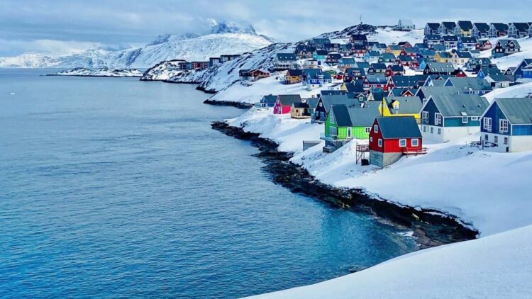
Greenland is changing its shape. After millions of years accumulating icen and dealing with ice meting periods, the island’s rocky base is moving; stretching in some places, and shirking in others.
An international team form the Technical University of Denmark (DTU) analyzed about 20 years of GPS data in about 58 points shared by the island, and they found that the territory moves to the northwest about 2 centimeters a year, while it expands in certain zones, it contracts in others. For science, and future Artic navigation, this matters a lot.
As Danjal Longfors explains, “Overall, this means Greenland is becoming slightly smaller, but that could change in the future with the accelerating melt we’re seeing now.” Behind these changes there are 3 geophysics forces: the plate tectonics, the weight relief by the current ice melt and the rebound inherited from the last Ice Age, known as Glacial Isostatic Adjustment (GIA). The study published by the Journal of Geophysical Research: Solid Earth, helps understand how the Earth’s crust respond to climate change and why ground deformation is not the same everywhere.
How the team measured the movement of the island
The Technical University of Denmark (DTU) team measured different sources of information to separate those 3 forces. On one hand, they used continuous GPS readings located throughout Greenland and computer models. On the other hand, they added data from several thousand GPS stations across North America, and estimates movements over the past 26,000 years. With all of this data, they were able to distinguish which part of the changes was caused by plate tectonics, which comes from the weight relief by the current ice melt and which belongs to the slow and very long-term rebound of the Glacial Isostatic Adjustment (GIA).
The result is the measurement of the most precise—to date—displacement of Greenland, especially in the horizontal component (that “shift” to the northwest).
According to Danjal Longfors Berg, “The ice that has melted in recent decades has pushed Greenland outward and caused uplift, so the area has actually become larger during this period”. Al mismo tiempo, dijo, “we see movement in the opposite direction, where Greenland is rising and contracting due to prehistoric changes in the ice masses related to the last Ice Age and its end.” In other words, there are forces that push out and old forces that still push in because of how ice change millions of year ago.
A finding that helps plan the Artic’s future
The consequences of this phenomenon are practical. If the flow moves, the fixed reference points are not so fixed anymore, right? This affects maps, civil works, coastal measurements and ship and aircraft routes in the Arctic, where the ice melt is opening up new sailing areas.
Danjal Longfors Berg puts it this way: “It’s important to understand the movements of landmasses… They are also crucial for surveying and navigation, since even the fixed reference points in Greenland are slowly shifting.” Furthermore, to understand how ground deforms, helps climate change models: if we know how to respond to Earth’s crust when ice is added or removed, then, we can better predict what will happen to the land and the coasts as the ice melt progresses.
The study shows that not all the land reacts the same way; some zones are rising and expanding, while others are also rising but shrinking.
A living planet that doesn’t stop moving
The investigation lead by the Technical University of Denmark (DTU) confirmas that Greenland is a natural laboratory where geophysics are seen in real time.
The Earth’s crust is alive and responding to what’s happening above, and understanding this makes it essential for deciding how to measure, navigate and build in a world that literally never stops moving.