The Roman Empire dominated so many places that we normally don’t even think of. Even on the highest mountains in Europe, they conquered. A new discovery from the University of Basel shows that their legions reached extreme places like the Swiss Alps, where they found the remains of a military camp built about 2,000 years ago, 2,134 meters above sea level.
This astonishing finding happened in the canton of Graubünden, which is a mountainous region east of Switzerland, and close to towns like Cunter and Tiefencastel.
The research reveals until what point the Romans were capable of adapting to difficult environments with the goal of expanding their territory and domain while protecting their commercial routes. According to the archaeologists, this camp helped to watch the strategic steps, control valleys, and guarantee that troops could move the goods safely across the Swiss Alps.
A camp in the heights
The place was designed with military precision; and from there, soldiers could observe valleys close by and control paths that would cross the mountains.
Researchers have identified remains of walls, defense ditches, and stone structures that marked the limits of the fort. Furthermore, the archaeologists also found lead projectiles engraved with the seal of the Third Roman Legion, one of the most recognized units from the Roman Empire.
This detail confirmed that the Roman legions were physically there, present in that really high point.
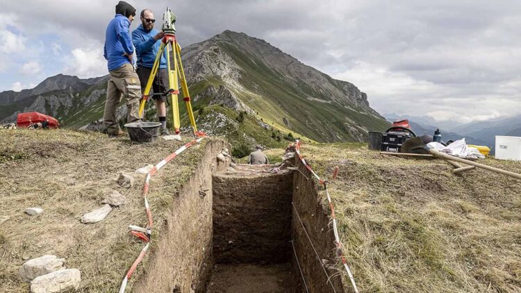
The University of Basel has been digging this zone since 2021, working along with the Archaeological Service of Graubünden. The main objective was to study old battle camps in the Oberhalbstein area, but what they found succeeded their expectations.
An archaeological surprise thanks to the LiDAR
The big twist in the investigations arrived in 2023. A document mentioned a “surprising terrain structure” at the Colm la Runga corridor, which was located about 900 meters above where the first studies had been done. To be able to examine the zone without endangering the landscape, the scientists used LiDAR technology. This tool emits thousands of laser pulses from the air and allows you to see the hidden relief under the vegetation or snow.
Thanks to the LiDAR results, the experts discovered a fort just at the tip of the mountain; the walls followed a typical pattern from the Roman camps; rectangles with rounded corners, internal paths, and zones for the troops and animals.
According to research, Roman legions would have come from Bergell, crossed the Septimer Pass, descended towards Tiefencastel, and followed towards Chur, trying to get to the Alpine Rhine Valley.
All of this changes the way the Roman presence in Switzerland is understood, showing that Roman Empire armies were also looking and building strategic positions in the highest points possible in the Swiss Alps.
The importance of the discovery for history
For the archaeologists from the University of Basel, the discovery in Graubünden is living proof that Swiss archaeology has a lot of potential. And also, this finding reinforces the idea that the Alpine routes were vital for the Roman Empire’s trade, communication and defense.
Those mountains were part of a strategic system. And from those elevated locations, soldiers could control every step from the enemies, anticipate attacks and protect the flow of goods between Italy and the northern regions.
The coins, weapons, and remains found in the site help reconstruct how the soldiers lived in such a hostile environment. But reveal that the weather, the snow and the altitude were not enough to stop the growth of an empire determined to connect every corner of its territory.
Today, more than two thousand years later, we can imagine the soldiers of the Third Roman Legion making history from above at the valleys of the Alpine Rhine Valley.